


New Delhi:
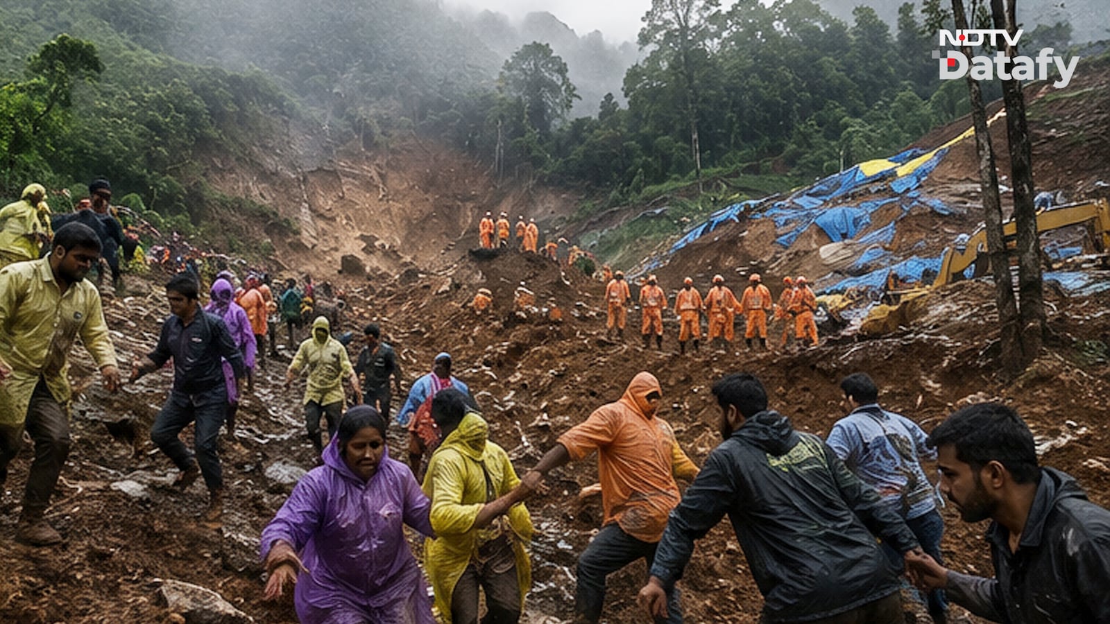
The devastating landslide in Kerala’s Wayanad has once again highlighted a worrying reality: extreme destruction does not always require extreme rainfall.
The disaster struck even though the district recorded below-normal rainfall during the week it occurred. While experts will determine whether it is a natural or a man-made disaster emerging due to ignorance, the tragedy underscores a larger concern. In districts like Wayanad, even a single landslide can cause disproportionate damage because of high population density and widespread human settlements in vulnerable terrain. And Wayanad is far from being an isolated case.
India’s Landslide Hotspots
India is among the four countries with the highest landslide risk in the world, with an estimated annual loss of more than one life per 100 sq km due to landslides. Most of these incidents occur during the monsoon.
According to government estimates, around 4.2 lakh sq km, or 12.6 per cent of India’s geographical area, is prone to landslides.
Of this, about 1.8 lakh sq km lies in the Northeast Himalayas, including Darjeeling and Sikkim, 1.4 lakh sq km in the northwestern Himalayas covering Uttarakhand, Himachal Pradesh and Jammu and Kashmir, 0.9 lakh sq km in the Western Ghats and Konkan region, and around 0.1 lakh sq km in the Eastern Ghats of Andhra Pradesh.
Where Is The Greatest Risk?
The danger from landslides is not determined only by how often they occur. It also depends on exposure. That means how many people, homes, roads and other infrastructure lie in areas vulnerable to landslides.
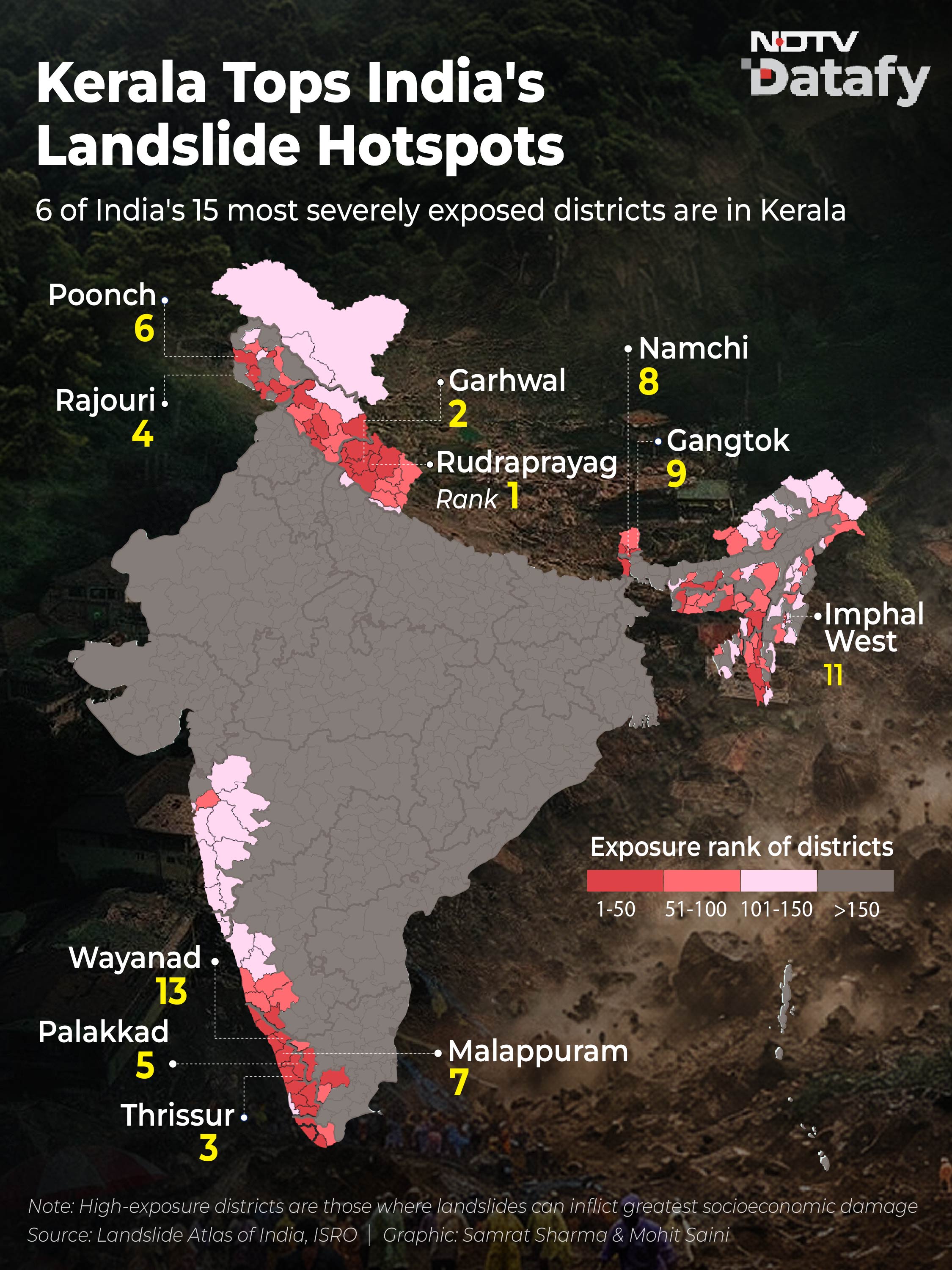
An ISRO study, Landslide Atlas of India (2023), analysed this intersection between landslide-prone terrain and human settlements. The study ranks Wayanad as the 13th most landslide-exposed district in India.
More significantly, six of the country’s 15 most exposed districts are in Kerala. Besides Wayanad, they include Thrissur, Palakkad, Malappuram, Kozhikode and Ernakulam.
Why Kerala Is More Vulnerable Than The Northeast
The Northeastern states witness far more landslides every year than Kerala. Yet, Kerala records much higher exposure. According to the ISRO report, the difference lies in population density.
Large parts of the Northeast consist of sparsely populated mountainous terrain, meaning many landslides occur away from settlements.
In contrast, the Western Ghats, particularly in Kerala, have dense populations, closely packed houses and extensive infrastructure spread across hilly terrain. As a result, even relatively fewer landslides can have far greater human and economic consequences.
“The vulnerability of the inhabitants and households is more significant in the Western Ghats due to the very high population and household density, especially in Kerala, even when fewer landslides exist than in the Himalayan regions,” the report notes.
Apart from Wayanad, Rudraprayag and Garhwal in Uttarakhand, followed by Rajouri in Jammu and Kashmir, are among India’s most landslide-exposed districts.