

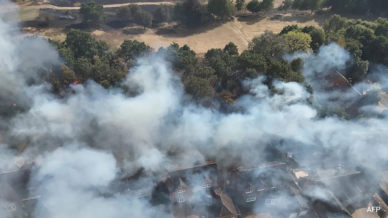
Over the past couple of weeks, firefighters have been working round the clock, tackling Belgium’s largest wildfire on record. As emergency teams work to rescue those trapped, the rains and cool weather have brought in some respite in the country.
The blaze in Belgium erupted following an intense heatwave with temperatures reaching 37 degrees C (98.6 degrees F), burning roughly 3,000 hectares of peatland and pine forest.
According to reports, the fire forced the evacuation of about 600 residents and tourists in the nearby border municipalities of Waimes and Butgenbach. More than 250 emergency personnel supported by military units, Belgian and German ground crews, local farmers, and firefighting aircraft deployed through the European Union’s civil protection mechanism worked to prevent the fire line from crossing from Belgium into western Germany.
A Summer Of Extremes
The fires in Belgium are a part of a broader picture of severe weather all across the Northern Hemisphere. Per data from the World Meteorological Organization (WMO), the global land and sea surface temperatures have reached record-breaking levels.
The international body stresses that the broader global pattern now sees extremes. “Extreme heat, persistent drought and dangerous wildfires have been the hallmarks of Northern Hemisphere summer for many countries, whilst heavy rainfall and flooding have caused loss of life in other parts of the world.”
Explaining the atmospheric mechanics behind these prolonged conditions, John Kennedy, head of climate information at the WMO, said, “What we have seen over the last few months is the combined effect of long-term warming with a persistent pattern of alternating high- and low-pressure systems stretching across the Northern Hemisphere. The high-pressure areas are more typically associated with high temperature and dry conditions, and the low-pressure areas are cooler and wetter.”
The organisation further cautions that these conditions, stubborn and stationary, have persisted for longer than usual. “These kinds of high-pressure patterns can last days or even, as we have seen this year, for weeks. In June, these areas of high pressure and the associated high temperatures simultaneously affected Central Asia, North America, and Western Europe,” read a statement from the organisation.
Naturally, with these weather conditions, these stationary “blocking” systems have created a ripple effect on other aspects of life. The systems have now severely depleted soil moisture and dropped water levels on major European rivers like the Seine, Rhine, and Danube.
Data cited by the WMO from the Copernicus Atmosphere Monitoring Service (CAMS) shows that wildfire emissions in France and Spain are running well above average for this time of year.
Ground Zero
Extreme heat and wildfires have hit several parts of Europe. The discussion regarding the heat and wildfires often mentions global climate drivers like El Nino. However, climate experts warn against drawing immediate parallels between ocean surface temperatures in the tropical Pacific and summer weather extremes across the European continent.
Prof. Martina Zelenakova, a professor at the Technical University of Kosice in Slovakia, explains that while El Nino exerts a global influence, its impact on European latitudes is indirect: “El Nino can affect the weather in Central Europe, but its impact is indirect and much weaker than, for example, in the tropical Pacific. It mainly involves changes in atmospheric circulation and the position of the radiation jet.”
According to Prof. Zelenakova, El Nino shifts statistical probabilities across seasons rather than guaranteeing specific weather outcomes:
Winter Conditions: El Nino increases the likelihood of weather patterns that bring warmer or wetter air into Europe, contributing to milder winters in Western and Southern Europe. However, the signal is weak in Central Europe, where individual winters still vary greatly.
Rainfall: While El Nino alters storm tracks, it does not dictate moisture levels in a straightforward direction. For countries such as Slovakia, the Czech Republic, Austria, or Hungary, an El Nino event cannot be automatically linked to higher or lower rainfall.
Extreme Events: Global oscillations change the probability and intensity of severe storms or temperature spikes, but local weather depends heavily on regional drivers like the North Atlantic Oscillation (NAO), the Arctic Oscillation (AO), and Atlantic Ocean temperatures.
Summer Heat: The link between El Nino and European summer weather is particularly weak. Summer heatwaves are driven mainly by local soil dryness, Atlantic conditions, and persistent high-pressure “blocking” systems that trap hot air over the continent.
Addressing common misconceptions about global climate forecasting, Prof. Zelenakova who hails from Slovakia speaks of her country: “One thing is important for Slovakia: El Nino does not work as a simple rule ‘El Nino = warm and dry Slovakia.’ Its influence is transmitted through changes in atmospheric circulation over the Atlantic and Europe and is relatively weak compared to the influence of the NAO, blocking high-pressure areas or climate change itself. However, research shows that certain statistical links exist.”
What’s Driving The Fires In Europe?
Experts argue that while El Nino is a natural cycle rather than a cause of long-term global warming, its strong phases temporarily raise global average surface temperatures. When an El Nino episode coincides with an already warmer climate baseline, heatwaves and dry spells can become even more severe.
Experts argue that the primary forces behind Europe’s escalating wildfire threats remain localised and structural: persistent atmospheric high-pressure blocks, deep drying of peat and topsoil, and ongoing human-caused climate change that increases the frequency and intensity of summer heatwaves across the continent.