


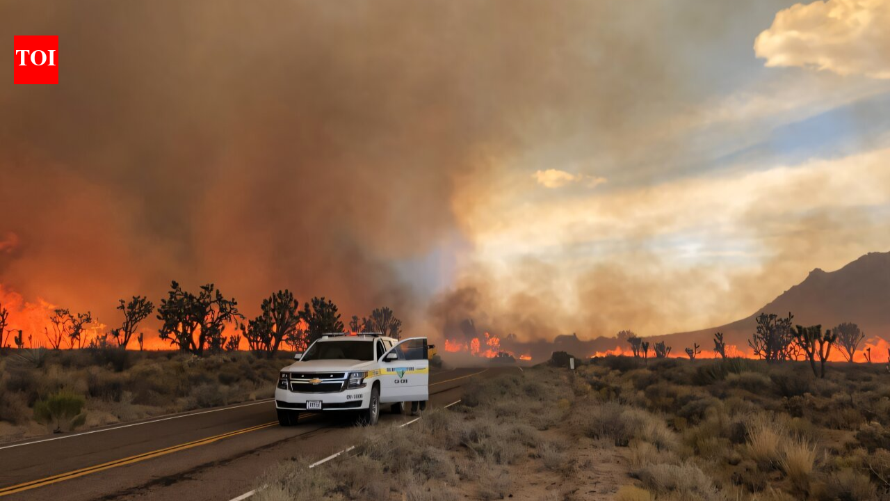
California lost as many as 1.3 million Joshua trees when the 43,000-acre (17,400-hectare) Dome Fire burned through the Mojave National Preserve in 2020.According to the University of California, Berkeley, scientists at the Eric and Wendy Schmidt Center for Data Science & Environment (DSE) have partnered with the US National Park Service to develop digital fire recovery tools. The new software helps park managers quickly map fire damage and focus restoration work on areas where fragile desert plants are most likely to survive.
Dystopian landscapes demand swift intervention
When UC Berkeley postdoctoral researchers Maya Zomer and Lucia Layritz travelled through burned parts of the Mojave National Preserve after the 2020 fire, they saw miles of charred vegetation that looked like a moonscape. Over time, the charcoal peeled away from burned Joshua trees, leaving behind white, skeleton-like trunks.“It looks like a pretty dystopian landscape,” Layritz said.Although researchers found green shoots and wildflowers growing through the sun-bleached soil, the plants face difficult chances of survival. Joshua trees (Yucca brevifolia and Yucca jaegeriana) can grow up to 40 feet (12 metres) tall and live for more than a century, but they can take up to 70 years to reach reproductive maturity.A 2019 study led by the University of California, Riverside, warned that rising temperatures and longer droughts caused by greenhouse gas emissions could wipe out Joshua trees across most of their historic range in Joshua Tree National Park by the end of the century.These climate pressures are made worse by invasive, non-native grasses. The weeds fill the gaps between desert shrubs, creating a continuous layer of dry fuel that allows large, intense fires to spread across landscapes that did not historically experience frequent fires.“The frequency, magnitude and spatial area of the burns have definitely experienced a huge ramp-up in the last eight to 10 years within the greater Mojave Desert,” said Maya Weltman-Fahs, a senior program manager at the Berkeley research center.Weltman-Fahs said most fires in the region are started by human activity, including recreational camping.“People were very concerned,” Layritz said. “It was like, OK, are we, I don’t know, five big fires away from destroying the majority of the Joshua trees? And what do we do if that happens?”
Adapting satellite technology for desert terrain
Unlike conifer forests, where standard satellite images can easily tell the difference between burned trees and healthy forest, desert ecosystems are much harder to study from space. Sparse vegetation and exposed rocky ground often reduce the accuracy of standard satellite burn measurements, making it difficult for park officials to quickly assess damage and apply for federal funding before restoration opportunities are lost.“The desert ecosystems are very different from, say, a burned versus an unburned forest and what that would look like from satellite imagery,” Weltman-Fahs said. “The desert had not been well-served by the existing comparative indices to examine the burn severity from satellite imagery. So that was the place that we started with our Joshua Tree partners—can we give you the information really quickly in the aftermath of a fire of what got burned, where, and how bad was it?”The team developed the DSE Disturbance Severity Tool, a mapping program designed specifically for dry desert environments. The Park Service used the software after two recent fires in Joshua Tree National Park: the 200-acre (81-hectare) Eureka Fire and the 2025 Black Rock Fire, which burned 72 acres (29 hectares) near a campsite.“We used DSE’s Disturbance Severity Tool twice last year to assess post-fire conditions following the Eureka and Black Rock fires,” said Nick Graver, botany and vegetation monitoring program lead at Joshua Tree National Park and a graduate student in UC Riverside’s Department of Evolution, Ecology and Organismal Biology. “Combined with field assessments conducted by park biologists, it provided the foundation for evaluating fire severity and developing recovery plans for both incidents.“
Scenario modeling directs limited conservation resources
In addition to mapping fire damage, the Berkeley team created a predictive platform called Josh. The interactive website allows park managers to test different long-term restoration strategies before planting nursery-grown seedlings or installing protective cages to keep herbivores away.“Josh is a scenario planning tool where you can play out different restoration strategies, like outplanting or herbivory protection, and understand what their potential is, especially when you consider climate change,” Layritz said.The software focuses on high-elevation areas known as “climate refugia.” These cooler locations are expected to provide the best long-term habitat for Joshua trees as global temperatures rise, but they also collect thick grass cover, making them especially vulnerable to severe fires.“The Mojave Desert may be at a critical shift from small, patchy fires to continuous large fires,” Zomer said. “That’s the motivation of a lot of work we are doing.”By combining immediate burn maps with the Josh simulation platform, field teams can identify exactly where to send ground crews for the greatest ecological benefit.“Resource limitation can also refer to how many boots they have on the ground to actually be going out and planting seedlings and watering them and helping support their establishment,” Weltman-Fahs said. “If they’re going to put forth that effort, they want to have a science-based, defensible reason to do that here rather than here.”The research center plans to improve the software so local park officials can run recovery models on their own as soon as future wildfires occur.



 Dome Fire burned through the Mojave National Preserve in 202.)